Estimating the time and effort of a route before you set off
In trail running, 15 km can take 3 hours or 5 hours depending on whether it climbs 300 or 1,500 metres. Here's how to get an estimate that accounts for the real terrain.
Why an average speed isn't enough
Dividing distance by a usual average speed gives a rough estimate that ignores the one thing that matters most: ascent radically changes an outing's pace. The same distance with a lot of climbing takes noticeably longer than a flat route, and descents don't fully make up for that extra cost.
The principle: distance and ascent combined
The editor calculates a duration that combines distance and ascent: every metre of climbing adds time (and, on a mountain bike, every metre of descent too), using values specific to seven sports profiles — walking, trail running, mountain biking, road cycling, gravel, kayaking and stand-up paddle.
The method builds on Naismith's rule: a base pace on the flat, plus a time per metre of ascent. The values for each sport have been calibrated on real tracks; for hiking, for example, 3.5 km/h plus one hour per 300 m of ascent.
📖 Step by step in the manual: How the duration is calculated (table of speeds by sport) · Pace
An example to gauge the gap
Two 15 km trail outings give a good sense of how much difference ascent alone can make: the first, on a rolling profile with 300 m of ascent, comes out at around three hours; the second, on a mountainous profile with 1,500 m of ascent over the same distance, goes up to five hours. The identical distance masks a very different reality of effort — which is exactly what the combined estimate corrects.
Fine-tuning the estimate with a personal profile
Choosing a pace — from Relaxed to All-out, or your own average — refines the result. The activity simulator goes further: with your age and weight, it also gives an expected average and maximum heart rate, an average cadence and calories burned for the chosen activity.
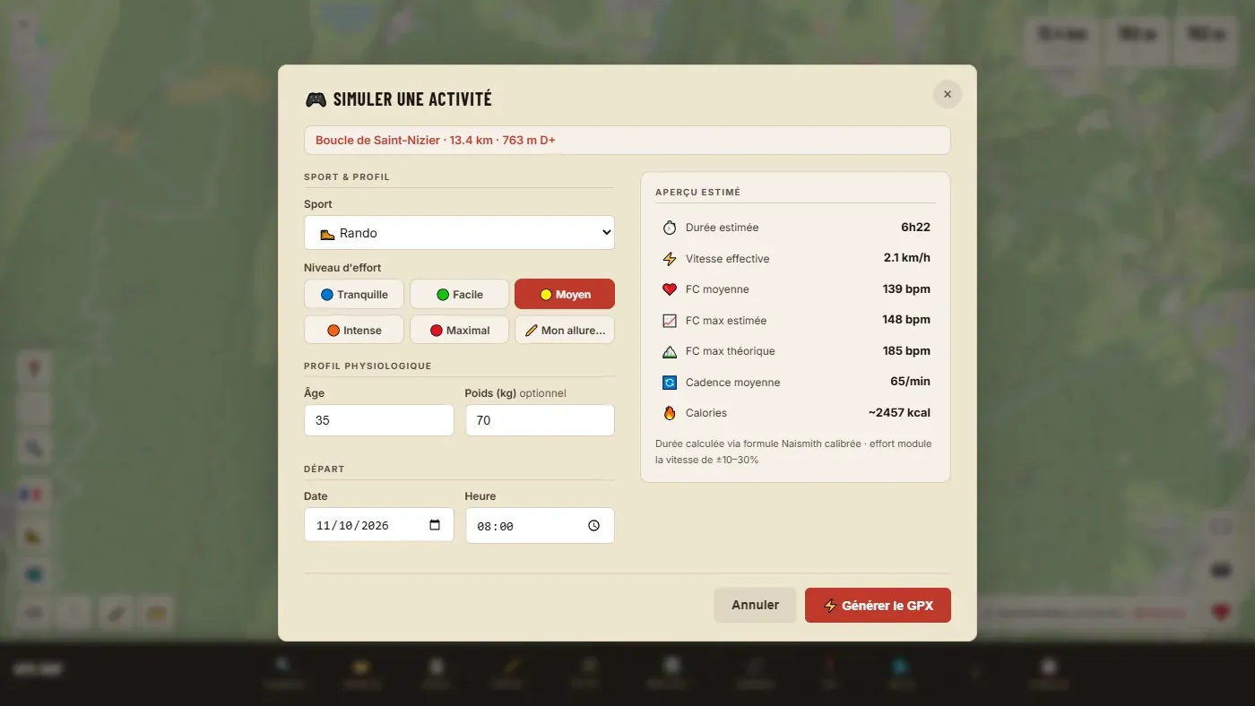
📖 Step by step in the manual: Simulate an activity · Route card
The special case of water sports
For kayaking and stand-up paddle, ascent doesn't mean anything: terrain is not counted for these two activities, and only distance counts in the estimate.
What this estimate is actually used for
The result mainly helps set a realistic departure time, plan water and food supplies, or judge whether a route stays reasonable before nightfall — rather than finding out on the ground. The estimated heart rate also gives a useful benchmark for pacing the start: setting off close to the average estimate rather than at full intensity from the first few kilometres avoids running out of energy on the second half of a hilly route.
Ready to try it on your own track?
Open the GPX editor for free →