Reducing a GPX file that's too heavy for a GPS unit
A GPS unit that lags or refuses to load a track usually has just one problem: too many points for what it can handle.
The symptom: a unit that refuses to load
A GPX file that takes an unusually long time to open, or that a GPS unit flatly refuses to load, is almost always suffering from the same problem: too many points relative to what the device can handle.
Why a file gets too heavy
Older-generation Garmin Edge units, entry-level GPS watches and some Wahoo devices set a points-per-file limit. A long recording — an ultra, a multi-day hike, a cycling tour — can pass 50,000 points and cross that limit without warning, right up until loading fails on the ground. File size in kilobytes tracks the point count directly: a GPX file is just a list of coordinates repeated point by point, with no compression — twice the points means twice the size.
Simplifying without distorting the track
Cutting down the point count shouldn't distort the track. That's the job of the Douglas-Peucker algorithm: it removes points that add no information about the track's shape — typically ones sitting on a straight line — and keeps the ones that mark a genuine change of direction, like bends.
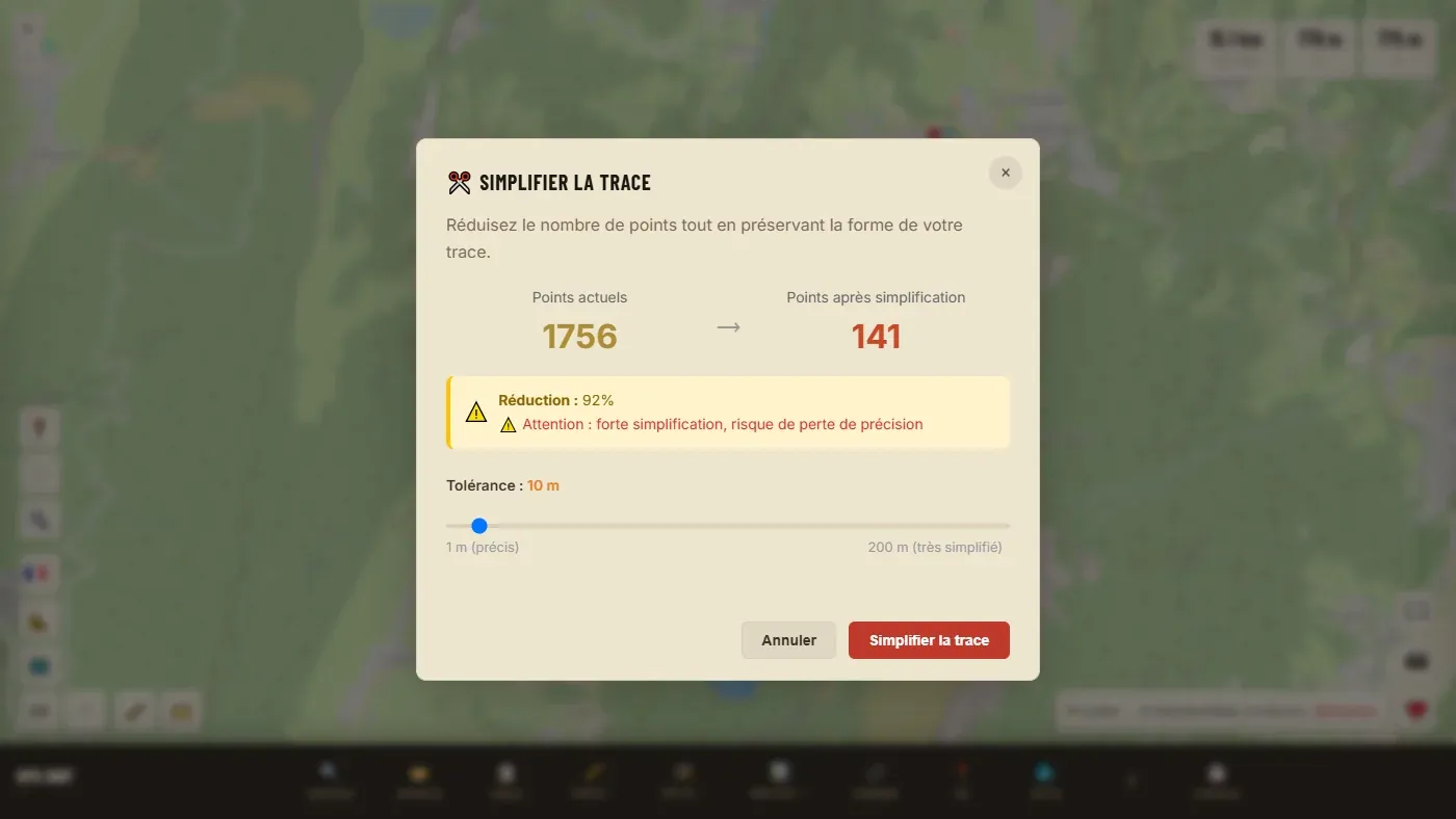
A slider sets the tolerance in metres, and a counter shows how many points will be kept before you confirm. On a watch recording, a tolerance of 5 to 10 m often removes more than 80% of the points with no visible distortion at map scale. A wrong step can be undone with Undo (Ctrl+Z).
📖 Step by step in the manual: Simplify · Clean up GPS spikes
Setting the tolerance and checking before you export
The higher the tolerance, the lighter the file, but the greater the risk of cutting a tight bend. Good practice is to start with a low tolerance, apply it, look at the technical sections on the map, then try one notch higher if the file is still too heavy. If a tight bend has been cut, Undo brings back the previous track.
The most common mistake: simplifying too hard, all at once
Applying a high tolerance straight away to save weight quickly tends to cut the tight switchbacks of a mountain road or the twists of a technical trail — exactly the places where the track's precision matters most. It's better to start from a low tolerance and raise it in steps, checking at each stage that the route's most winding sections stay faithful to the original.
What about a track that's already had its elevation corrected
Simplification acts on the point count, not on already-corrected elevation values — the two operations are independent and can happen in whichever order suits, without one undoing the other's work.
Ready to try it on your own track?
Open the GPX editor for free →