Planning food stops and accommodation for a multi-day trip
Over several days, the track alone isn't enough: you also need to know where to sleep and where to top up on water. Here's how to plan both alongside the route.
What changes on a multi-day trip
A single-day outing is planned around a track and a profile. A multi-day trip adds a layer: where to sleep, where to stock up on water or food, how far apart these points are. These markers are as much a part of the planning as the track itself. A 300 km cycling tour split into four 75 km stages isn't planned the same way as one continuous track: each stage has its own food stop to plan, its own weather, its own accommodation to arrange.
Marking food stops and accommodation
Every useful point — a fountain, a shop, a campsite, a guesthouse — can be marked directly on the map with a personal note attached: an opening time, a booking reference, a remark like "last water point for 20 km". These markers stay attached to the file and end up in the final GPX export, viewable out on the trail alongside the track itself.
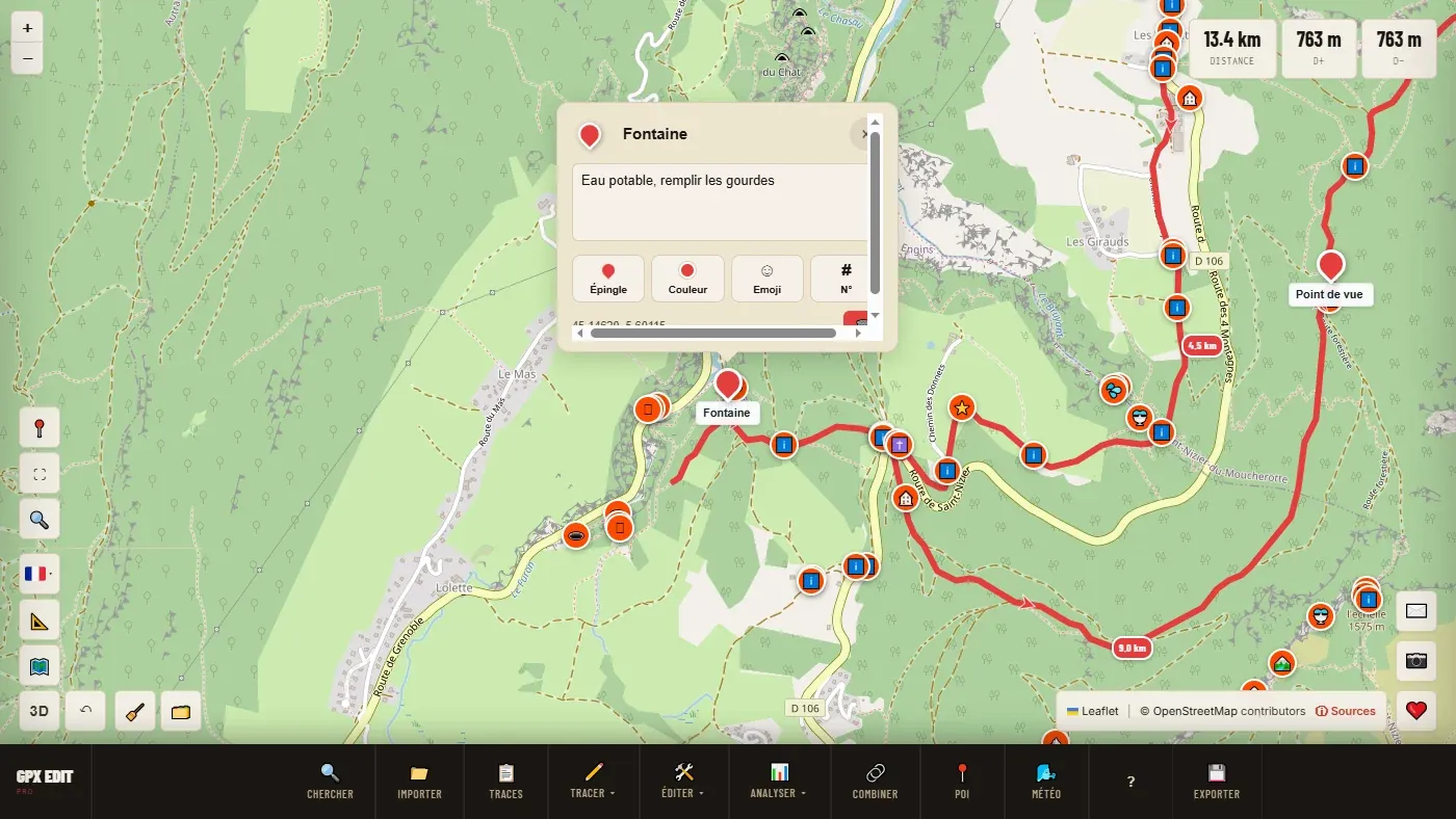
📖 Step by step in the manual: Place a marker · Points of interest
Splitting the route into daily stages
Once the full route is plotted, it splits at the planned overnight stops rather than being built stage by stage from the start — the method is covered in the guide on creating a route from scratch. Each stage becomes an independent file, with its own profile and its own distance.
Splitting at regular intervals can also automatically divide a long track into stages of comparable length, before you fine-tune the split points by hand to match accommodation that's actually available.
Conversely, stages prepared separately can be brought together into a single file with a merge in "Itinerary" mode: each stage remains a separate segment, and the GPS knows where each day ends. For each stage, the route card then gives the passing time at each waypoint and the arrival time.
📖 Step by step in the manual: Split by interval · Merge (Itinerary mode) · Route card · PDF map
Checking the weather for each stage separately
Once the stages are split, the 7-day forecast can be checked stage by stage rather than for the whole trip at once — useful for spotting that only one day out of four looks like trouble, and adjusting the stage order or building in a rest day accordingly, rather than giving up on the trip altogether.
Taking the whole plan out on the trail
For a multi-day trip, one PDF map per stage — map, profile, waypoints and route card for the day, gathered in a single ZIP file — is often handier to check than a GPX file alone, alongside the track loaded on your GPS or phone.
Ready to try it on your own track?
Open the GPX editor for free →