Checking the weather before a kite, wing or windsurf session
A good session means enough wind, gusts that stay reasonable, and wind that doesn't come from the land. Here is how to check it in a few minutes, from the map of Europe down to the exact hour at your spot.
Start wide: the overview
Open the weather map with the Weather button in the toolbar (on a phone: Analyze → Weather map) and zoom out until you can see the Atlantic, the Channel and the Mediterranean. The animated lines are the wind, coloured by strength from 0 to 65 km/h and above; the km/h ⇄ kn button in the legend switches to knots. At sea, the arrows and figures give the direction and height of the waves.
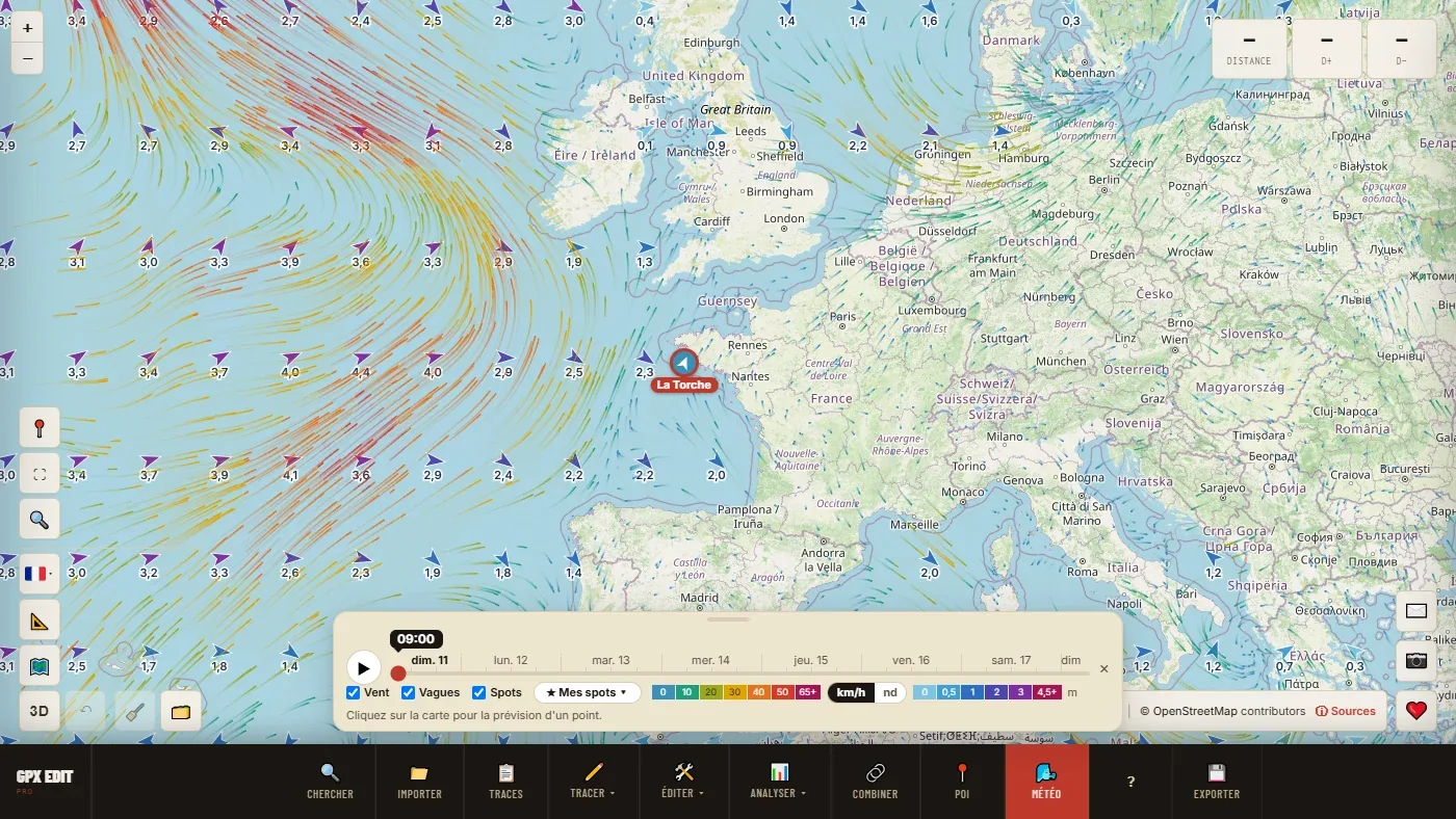
The slider covers the next 7 days, hour by hour. The ▶ button plays it: you see a low arrive, the wind veer and strengthen on the coast. That's where you spot the day the wind fills in.
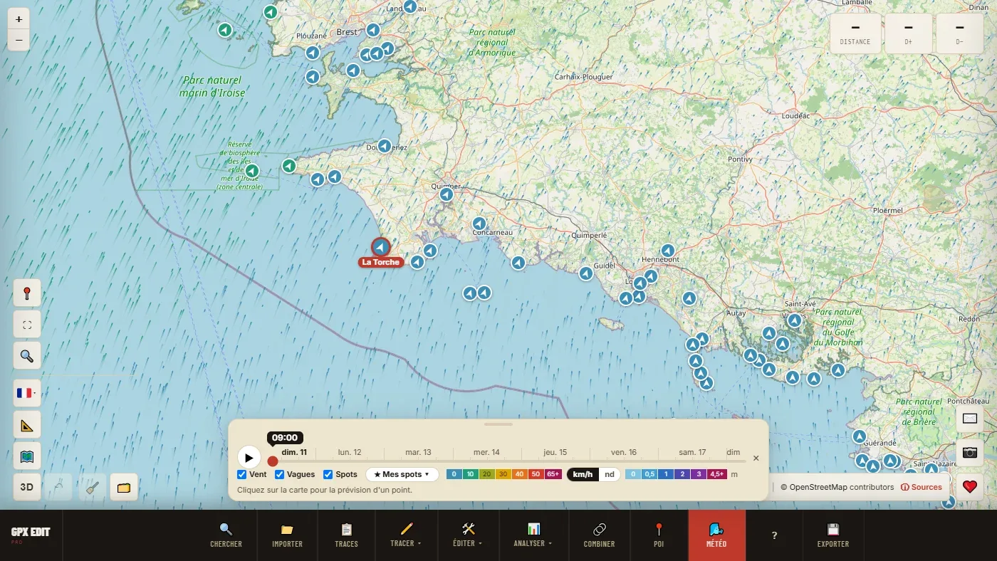
Then move in closer to your coast, with the Spots box ticked. Kite, windsurf and surf spots, and sailing clubs, take the colour of the wind at the slider's hour: as you drag the slider, you see which spot gets the right wind, and when.
Reading your spot's forecast
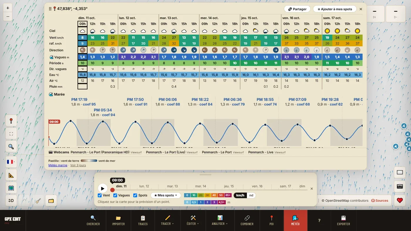
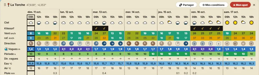
Click the spot, or anywhere on the beach, to open the forecast for that point. The columns go in 3-hour steps, in daylight only.
| Row | What to look at |
|---|---|
| Wind | The mean wind, in the map's colours. This is what decides the size of kite or sail. |
| gusts | The gusts. A gap of more than 15 km/h with the mean wind means irregular wind, with lulls and overpowered moments. |
| Direction | The arrow points to where the wind is going. Hover over it for the bearing in degrees. The dot around the arrow says where it comes from: brown, from the land; blue, from the sea; in between, it blows along the coast. |
| Waves, period | For waves: height and period. Below 8 s, short chop; around 10 to 12 s, a well-organised swell. |
| Water | The sea temperature, in blue below 17 °C: enough to choose your wetsuit. |
| Sky | Showers and thunderstorms. A thunderstorm means calling off the session, whatever the wind. |
In France, Spain and Portugal, the wind comes from Météo-France's AROME model, on a 1.5 km grid. Within 2 km of the shore, it is taken from the sea cell, not over land where it is slowed down: it's the wind you will have on the water.
Offshore wind, the trap to avoid
Wind coming from the land (offshore) has two flaws. It has crossed dunes, houses and trees: it arrives gusty and patchy. And it pushes you out to sea: if something breaks, you fall or the wind drops, you won't get back to the shore on your own. That's why the Kitesurfing and Windsurf / wing presets rule out the hours when it blows from the land.
Onshore wind brings you back towards the beach, but makes launching harder in the waves. Many spots work best when it blows along the coast (side-shore): the dot is then between brown and blue.
Setting your conditions once and for all
- Save the spotIn the forecast, ☆ Add to my spots, then a name. The spot appears on the map circled in red.
- Open My conditions⚙ My conditions, at the top of the saved spot's forecast.
- Start from a presetKitesurfing, or Windsurf / wing, then adjust to your level and your gear.
- Say when you are availableA window of at least 2 h, the days, the hours. OK.
| Preset | Wind | Gusts at most | Other criteria |
|---|---|---|---|
| Kitesurfing | 20 to 45 km/h (≈ 11 to 24 kn) | 60 km/h | No offshore wind, no thunderstorm, 2 h window |
| Windsurf / wing | 18 to 50 km/h (≈ 10 to 27 kn) | 65 km/h | No offshore wind, no thunderstorm, 2 h window |
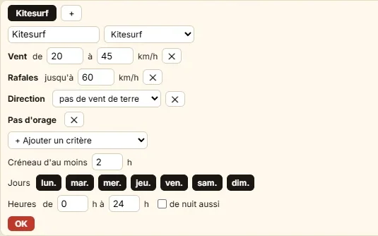
- Two kites, two sets: the + next to the tab creates another set for the same spot, up to four. "Kite 12 m" from 18 to 28 km/h, "Kite 9 m" from 26 to 40 km/h.
- A spot that only works in one sector: add Wind direction, for example from 225° to 315° for south-west to north-west.
- Steady wind: add Gusts above mean wind, 15 km/h at most.
- After work: days Monday to Friday, hours from 17 to 21.
Reading the result
The forecast gains a row named after the set, ticked ✓ at every hour that meets all your criteria within a long enough window.
The ★ My spots ▾ button in the bottom bar becomes a dashboard: under each spot, the next window, where the wind comes from, and the best window of the week when it isn't the next one. If there is nothing in 7 days, the list says why: "nothing in 7 days (wind)" — that's the criterion to relax.

Before you hit the road
- The 📷 Webcams row under the forecast opens the webcams within 3 km: a look at the water.
- 🔗 Share copies a link that opens the weather map on your spot: handy to send to the group.
- The Marine forecast link, under the forecast, opens the official bulletin.
The colours and the ✓ reflect a forecast and your own criteria, not a safety level. Look at the water, ask the regulars, and the decision to go out remains yours.
📖 Step by step in the manual: Overview · The spot forecast · My spots · My conditions
Find your next window.
Open the weather map →