Weather map: the wind, waves and tide at your spot
For kitesurfing, wing foiling, windsurfing, surfing, sailing, sea kayaking and paddleboarding: the wind across Europe, then your spot hour by hour. Free, no account.
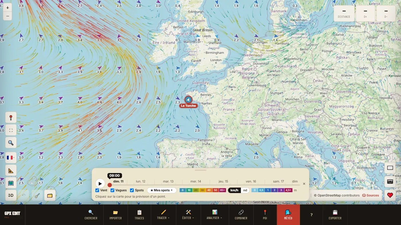
What the map shows
- Animated wind, coloured by strength, in km/h or knots, over 7 days with a slider and a ▶ button.
- Waves at sea: direction and height.
- Spots for kitesurfing, windsurfing, surfing and paddleboarding, and sailing and kayak clubs, coloured by the wind of the hour.
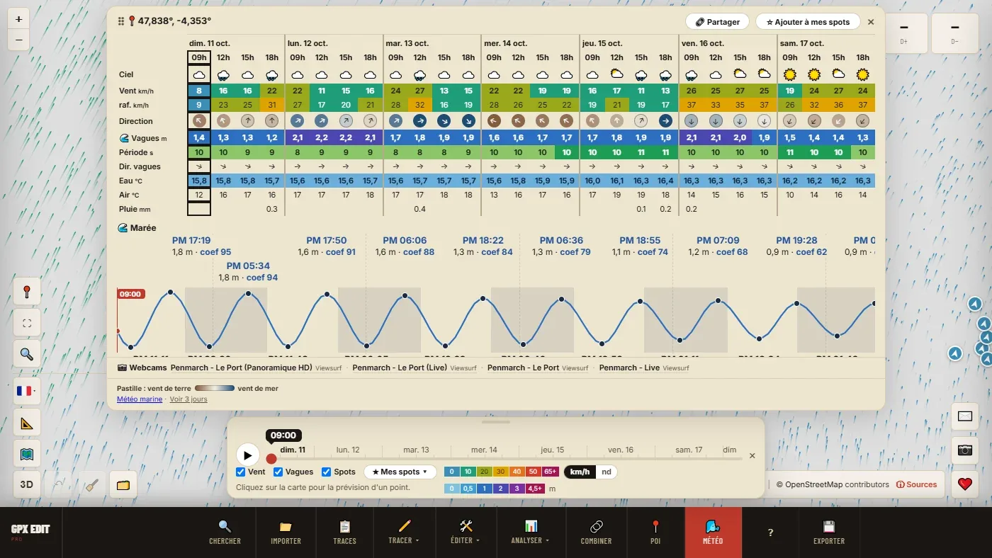
- The forecast for a point, in one click: wind, gusts, direction with an offshore or onshore wind dot, waves, period, water, air, rain, tide and coefficient, webcams within 3 km.
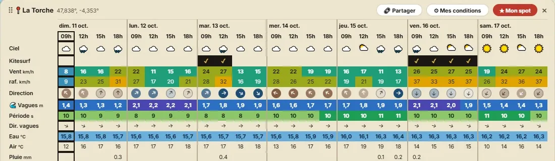
Your spots, your conditions, your window
Save up to 50 spots. For each one, say what makes a good session: a Kitesurfing, Windsurf / wing, Surfing, Sailing, Sea kayaking or Paddleboarding preset, to adjust. The forecast ticks the right hours, and the list of your spots shows the next window over 7 days — or what is blocking it.
In France, Spain and Portugal, the wind comes from Météo-France's AROME model (1.5 km grid); in Switzerland, from MeteoSwiss; in Italy, from ItaliaMeteo. Within 2 km of the shore, it is taken from the sea cell. The data comes from Open-Meteo.
Open the forecast for a well-known spot
- La Torche
- Penthièvre (Quiberon)
- Les Saintes-Maries-de-la-Mer
- Almanarre (Hyères)
- Leucate
- Wissant
- La Baule
- Hossegor
- Tarifa
Your spot isn't listed? Open the map and click the place: the forecast works everywhere. The 🔗 Share button creates the same kind of link for your spot.
Going further
- Checking the weather before a kite, wing or windsurf session
- Planning a sea kayak or paddleboard outing
- The Weather map chapter of the manual, setting by setting
The colours reflect intensity, not a safety level. The tide is calculated: for navigation, the official tide tables (the SHOM in France) are authoritative. The decision to go out remains yours.
Free, no account, nothing to install.
Open the weather map →